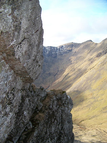
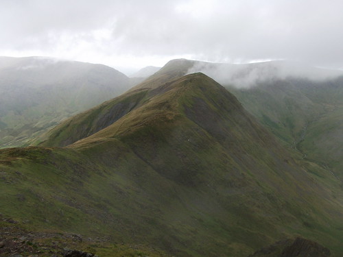
Liverpool Echo - Ain't No Mountain High Enoughtag:blogs.liverpoolecho.co.uk,2008-02-08:/aintnomountainhighenough//9802012-06-08T15:43:24ZMovable Type Enterprise 4.35-enScrambling after work - Brown Cove Cragstag:blogs.liverpoolecho.co.uk,2012:/aintnomountainhighenough//980.3990262012-06-08T15:21:43Z2012-06-08T15:43:24Z Brown Cove Crags are hidden behind the rounded shoulder of Whiteside near Helvellyn. But in amongst the crags are some decent scrambles....Richard Downhttp://blogs.liverpoolecho.co.uk/aintnomountainhighenough/
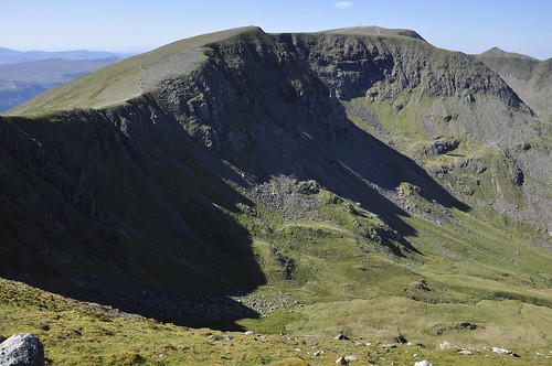
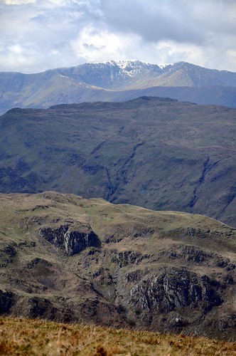
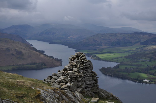
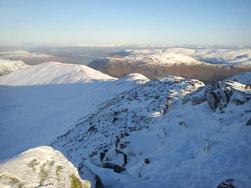
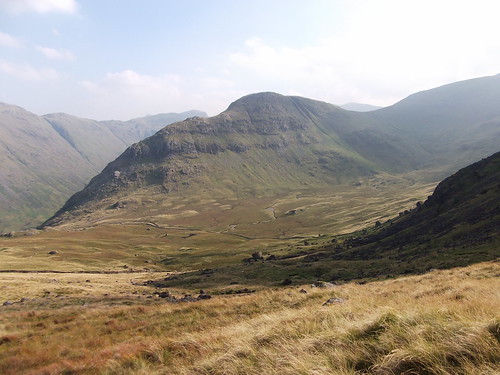
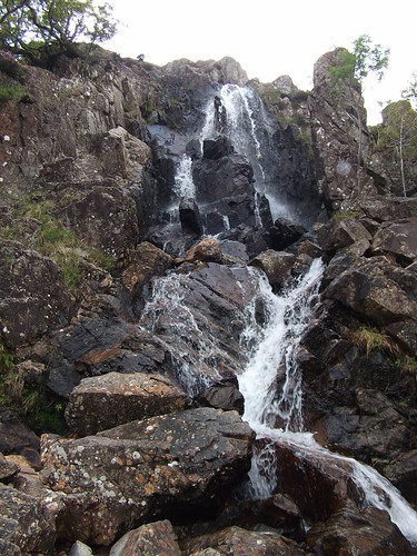
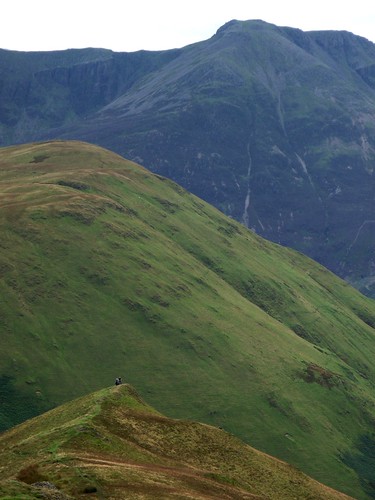
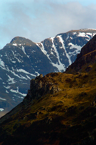
Brown Cove Crags are hidden behind the rounded shoulder of Whiteside near Helvellyn. But in amongst the crags are some decent scrambles.]]>
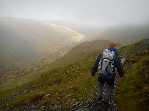
With a rare glimpse of Cumbrian sun of a Friday, I headed out with a colleague who is preparing to climb the Matterhorn this summer.
(image taken from building-traveling.blogspot.com)
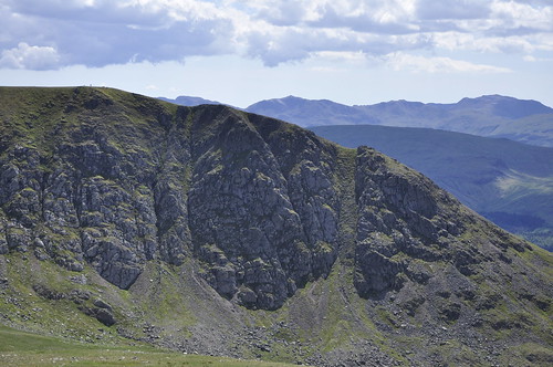
Brown Cove Crags are hardly Alpine but they are steep and offer a Lakeland Grade 3*** scramble - that's about a Grade 2 in Wales.
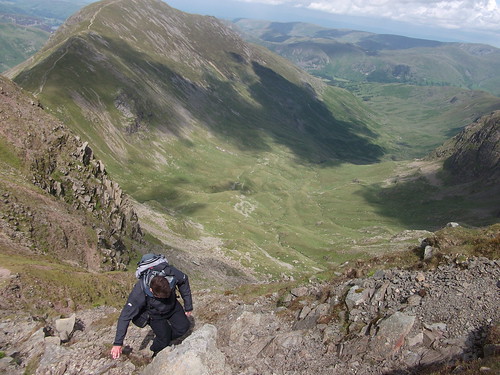
We followed the route laid out in the Cicerone Guide, 'Scrambles in the Lake District - Northern Lakes'. I set off at a furious pace and then remembered how unfit I am thanks to a coronary halfway up the approach from Swirls Car Park near Thirlmere - a popular place to climb Helvellyn. From the bottom the bluff is quite imposing and you need to find the base of the obvious big buttress to begin the climb. From there it's pretty straightforward with little to get your knickers in a twist. The only technical bit is Riley's Window at the top of the climb but that is easily bypassed.
All in all a decent 2 hour outing.
]]>
Pavlov and the art of preparation on Helvellyn - a masterclass in self-inflicted paintag:blogs.liverpoolecho.co.uk,2012:/aintnomountainhighenough//980.3985872012-05-27T15:28:22Z2012-05-27T16:06:38ZThe best way to prepare for a walk that might break you is, of course, to break yourself and then go for out for a walk - preferably up something steep and high. England's third highest being a perfect choice....Richard Downhttp://blogs.liverpoolecho.co.uk/aintnomountainhighenough/
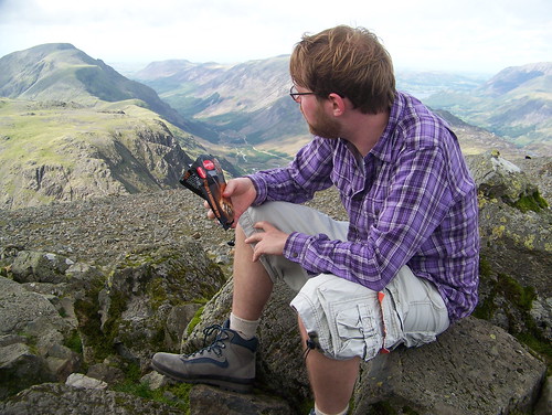
The best way to prepare for a walk that might break you is, of course, to break yourself and then go for out for a walk - preferably up something steep and high. England's third highest being a perfect choice.
Thus, after a low stakes poker night at a friend's house which finished at about 4am, I rose at 9am, strapped on some inappropriate clothing and took off up the side of Helvellyn in fierce 80degree heat.]]>
Just to ensure maximum grief, I made sure not to run the tap before filling my water bottles. This provided me with 3.5 litres of lukewarm cloudy swamp juice.
Finally, in an act befitting of the sort of preparation last seen on Rumdoodle I took with me some "Ooops!" rolls purchased two days before from the discount shelf at Asda and a tub of Cheese and Pickle spread - like Cheese and Chive only brown.
As a result, I have little idea of what large sections of the walk were like as I was faintly delirious.
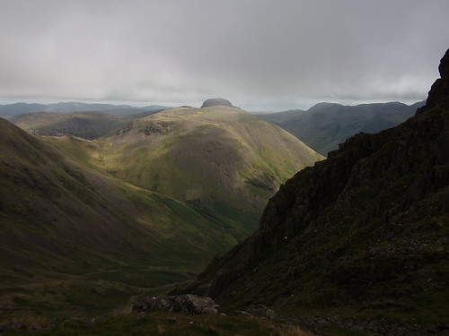
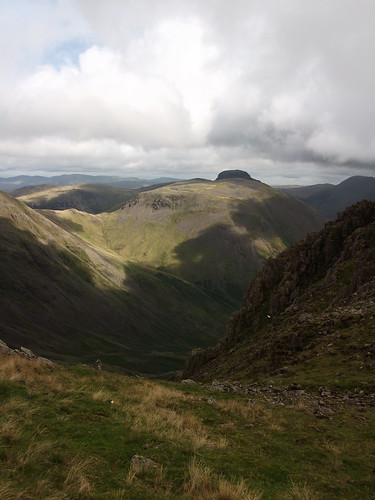
I did, however, have a camera with me and appear to taken some photos. They appear to indicate that I completed a circular walk including 5 Wainwrights from Helvellyn to Seat Sandal. Some of the pictures ring a bell and have set off a Pavolian reflex in my stomach that necessitates that I cut this blog post short...
Far better blogs exist detailing what this walk is like when the cyclone of fear and loathing is not shredding one's internal organs while the external bits are being sundried like a Co-op deli style starter.
They are:
Fellwalk's photoblog of the walk.
Hill climbers' fact filled file of fun.
Walk Highlands took a trip south of Hadrian's Wall to do the same trek and supplies a useful map of the route.
While Women's Sandals is an unlinked page that certainly doesn't get you anywhere in trying to find out more about Seat Sandal. It is inadvisable to use any of the featured items of footwear for a walk of this type or if male unless a member of a sociable rugby team.]]>
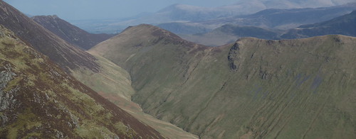
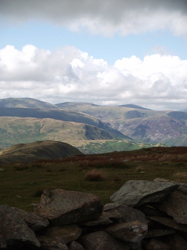
A long loop in the Far Eastern Fells - Beda Fell to Steel Fell via Rest Dodd and Kidsty Piketag:blogs.liverpoolecho.co.uk,2012:/aintnomountainhighenough//980.3974682012-05-06T16:23:14Z2012-05-06T17:14:59ZIf I'm going to manage this mountain challenge I've been banging on about, then it stands to reason that I should be attempting some longer loops. Today, however, after completing a fairly long stretch in Wainwright's Far Eastern Fells, I...Richard Downhttp://blogs.liverpoolecho.co.uk/aintnomountainhighenough/
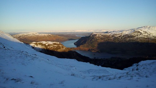
If I'm going to manage this mountain challenge I've been banging on about, then it stands to reason that I should be attempting some longer loops. Today, however, after completing a fairly long stretch in Wainwright's Far Eastern Fells, I am not standing very well at all; the reason is my calf muscle - an ominous tweak sustained early in a longish walk.It all started well enough in bright sunlight and a sharp spring breeze.Ullswater and surrounding fells are patchworked with green fields the closer you get to Penrith and they make a very nice backdrop to stare at as you lumber up the nose of the landbound peninsula Beda Fell.]]>
With some 15 miles to go, however, my mind was not on the scenery as much as on the back of my right calf which was cramping painfully.Ahead of me was Steel Fell (553m), Angletarn Pikes (567m), Rest Dodd (696m), The Nab (567m), The Knott (739m), Rampsgill Head (792m), Kidsty Pike (780m) and High Raise (802m). This was going to be a long limp unless I could stretch it out.Cue endless odd contorted Yoga style positions being thrown when I thought I was clear of other ramblers and eccentric lunges in hidden hollows that on more than one occasion startled otherwise rather blase Herdwick sheep. But the cramp grew however gamely I adopted hitherto untested Calisthenics poses amid the bracken and young heather groves along Beda Fell.
I was making progress though and the long valley of Martindale was soon behind me.
As Glenridding appeared from behind the spectacular and underated Place Fell on the shores of Ullswater, I began to think I'd beaten it.
Only to find that an unwise and improbable stretch close to Angletarn Pikes was to bugger it entirely.
From this point, it was a struggle.
I was a third the way round (see the map below) and had most of the Wainwrights I'd set out to bag to go.
EveryTrail - Find hiking trails in California and beyond]]>
Getting fit: 5 Wainwrights near Ullswatertag:blogs.liverpoolecho.co.uk,2012:/aintnomountainhighenough//980.3966722012-04-21T20:02:15Z2012-04-21T19:41:43Z Given the fact that the last thing I posted was about the fact I needed to get fit in order to take on a big ole mountain marathon in the summer, you'd be forgiven for wondering why I have...Richard Downhttp://blogs.liverpoolecho.co.uk/aintnomountainhighenough/
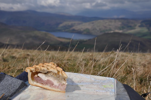
Given the fact that the last thing I posted was about the fact I needed to get fit in order to take on a big ole mountain marathon in the summer, you'd be forgiven for wondering why I have followed up with pie.
I have no reasonable explanation.
It is simply a slice of Cranston's Ullswater Pie high above the eponymous lake and was pretty tasty - strengthening too, I'd imagine.]]>
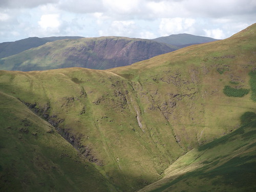
It was the first Saturday in a long time that I was able to get out early enough on a day where the clouds were higher than ankle height to even think about a decent round. Having dropped Samantha off in Penrith and bought The Pie (click here for another shot of the aformentioned baked good, this time in portrait) I was just 30 mins from the what Wainwright termed the Far Eastern Fells - a great opportunity to bag a selection of lower lying hills leading to High Street along the Roman Road.
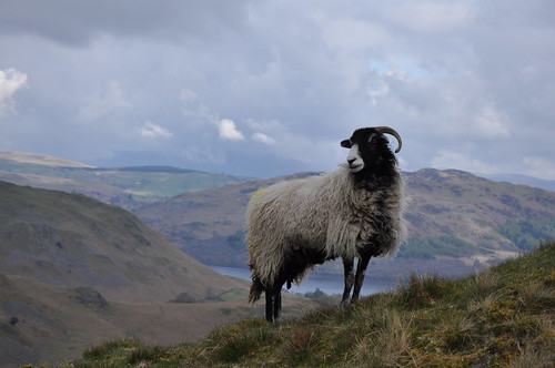
I parked on the slipway in Howtown and blasted straight up the front of Steel Knotts (410m) pausing only briefly at the behest of a particularly posy sheep.
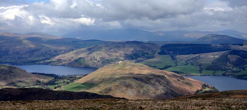
The slender ridge line curls round above Martindale and over the illnamed Gowk Hill (469m) - only Barf manages a less attractive moniker in the Lakes. From there, with the sun beginning to push through the clouds, there are several routes up to Red Crag (711m) and the High Street Roman Road. Across the valley, above the lower serpentine ridges of Beda Fell and The Nab Helvellyn was emerging from beneath a thick head of cumulous.
Red Crag is neither red nor craggy from this direction and well worth ignoring. Wether Hill (670m) was no more than a squelchy undulating trott with little to recommend it. But Loadpot Hill (671m), aside from being well-named, has terrific views. Although not from the trigpoint which was very heavily guarded when I got there.
In one direction the now fully clear Helvellyn with whisps of snow.
While in the other Ullswater and Hallin Fell alternately slate grey and deep blue.
With St Sunday Crag looming in the middle distance if you stared into the wind.
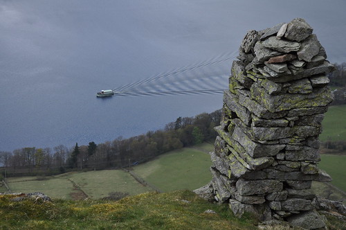
The rest of the walk can be done by following the old Roman Road. They evidently didn't like views though and so a more inviting sheep track runs along Bonscale Pike and Arthur's Pike (both 520m) with steep views onto the lake. Odd towers have been errected on the hillsides and below the steamers plough Vs across the surface of the Water.
I ended the walk by plunging down the craggy face of Arthur's Pike. It's the type of silliness I seem only to engage in when alone. Most people become more conservative when they are out on their todd. I on the otherhand see it as an excuse to do silly things that should end in disaster.
So far I have been lucky.
I think it was the pie. ]]>
Foolhardy plans for a really painful Mountain Marathon bagging the Lake District 3000stag:blogs.liverpoolecho.co.uk,2012:/aintnomountainhighenough//980.3963602012-04-17T18:19:40Z2012-04-17T19:07:52ZAfter a prolonged absence from writing anything for this site, I've decided to post about a decidedly idiotic Mountain Marathon I have in mind for this summer - in all probability it is beyond me. Proposed Mountain Marathon EveryTrail -...Richard Downhttp://blogs.liverpoolecho.co.uk/aintnomountainhighenough/
After a prolonged absence from writing anything for this site, I've decided to post about a decidedly idiotic Mountain Marathon I have in mind for this summer - in all probability it is beyond me.
EveryTrail - Find hiking trails in California and beyond
You'll need to zoom in to see the first draft of what I have in mind - 44 miles of agro over some 15 major Lake District fells including Scafell Pike, Helvellyn and Skiddaw. At present I'd like to do it without artificial aids, ie a car.]]>
But that may prove impossible.
For some, however, it's a jog:
44.1 miles / 70.9720704 km
Created 06.30.11 by Spudnic
In fact, it's half of a Bob Graham Round which I think you'll agree is a silly round for normal human specimens like me.
However, I'm very much in need of a challenge and I very much want to raise a bit of cash and mark the passing of one of the best people I've ever known - my mate Jim, or Dr Fish as he self applied.
The Where2Walk site says: "Whereas the Bob Graham round is a fell race covering 72 miles, 27,000 foot (pretty much the height of Everest) and 42 Wainwright peaks the walking challenge is a mere 43 miles, over 8,000 foot and 4 peaks but both have to be completed within 24 hours. I have not done this yet but it is certainly achievable for the fit fell walker."
I think this maybe the issue. Fit I am not.
But it's only April.
Ideally I'd like to get it on in June as that's when the days are longest but the demands of assignments and teaching may blow that out of the water. Perhaps early August?
As Lake District Challenges notes, it's totally doable in 2 days. But that sort of ruins the challenge. I reckon a 24 hour bash with mountain bike links between the three main sections and Swedish massage at key stages throughout....
though that's not exactly what I had in mind.
Anyway, it's all in the mix at the moment and the whole challenge is likely to morph a bit before I actually embark on it. Writing this post effectively throws down the gauntlet publicly.
]]>
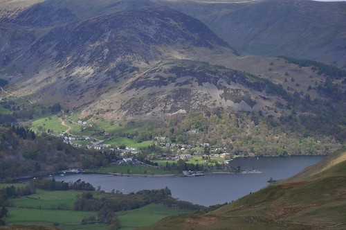
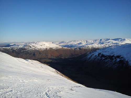
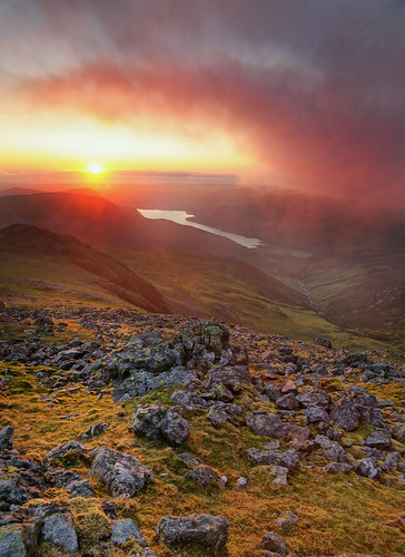
Winter on Striding Edgetag:blogs.liverpoolecho.co.uk,2011:/aintnomountainhighenough//980.3849032011-12-28T13:49:21Z2011-12-28T14:24:31Z Lake District children's author Arthur Ransome wrote "We Didn't Mean to Go to Sea" about a group of kids who accidentally end up crossing the world's busiest shipping lanes in a dingy. Their adventure ends in Holland having started...Richard Downhttp://blogs.liverpoolecho.co.uk/aintnomountainhighenough/
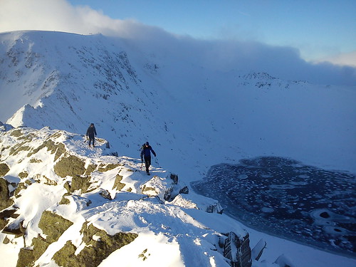
Lake District children's author Arthur Ransome wrote "We Didn't Mean to Go to Sea" about a group of kids who accidentally end up crossing the world's busiest shipping lanes in a dingy. Their adventure ends in Holland having started out as a short outing on an estuary. In much the same way I found myself on Striding Edge in gale force winds with about three inches of snow pasted to the rocky ridge line. I'd only intended to walk along the valley floor and perhaps up to Grizedale Tarn.
]]>
However, the sunlight and the glorious conditions were too much of an invitation.
The map showed a path leading gently up the side of Birkhouse Moor and the trail could be seen wandering into the snowline quite clearly. And before long I was above the snowline and staggered by the views that had sneaked up behind my back.
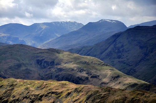
The snow drifted up to knee height on occasion and this made the going slow but safe as it supported my weight as I climbed. About half an hours steady pull later and the Helvellyn bowl emerged behind serious drifts of snow.
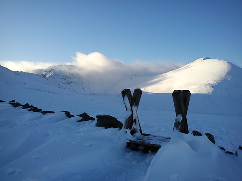
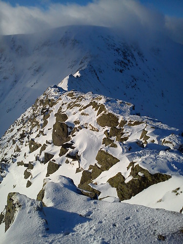
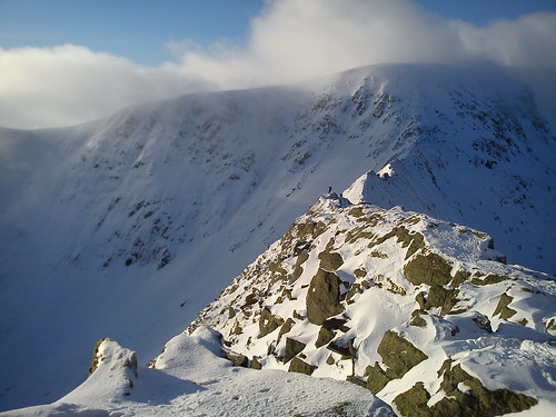
Some well prepared mountain types informed me that they'd narrowly been missed by an avalanche while doing a winter gully earlier that day. Stiles were almost entirely submerged and clouds were sweeping in from the north. However, sunlight was picking out the narrowing ridge from Birkhouse to Striding Edge and like a moth to the flame I was drawn upwards. After another 15 mins of pleasant walking the Lake District's most famous ridgeline divided frozen tarn from darkened valley and led towards heavy, storm tossed clouds.
At this point I noticed that there were few other people on the ridge and the wind had become fierce enough to force me to duck down between rocks on the apex of the ridge. I spent about 10 minutes waiting for fully cramponed walkers to make their way across and then jumped up to say hello causing mild surprise and muffled epithets from the careful mountaineers who believed the dangers were behind them.
With the wind reaching alarming speeds and flurries of spinddrift smiting my eyeballs I turned tail and headed back down following a drystone wall capped ridge back into Patterdale.
The sun was setting over Ullswater and I was beginning to think about how well my little car was going to cope with the road pass out of the valley.
In the past Striding Edge has disappointed. It has so many opt outs that it loses what sense of drama the natural geography suggests. However, this visit in thick snow with slanting sunlight and banks of heavy cloud lived up to the preconceptions I had before moving to Cumbria.
]]>
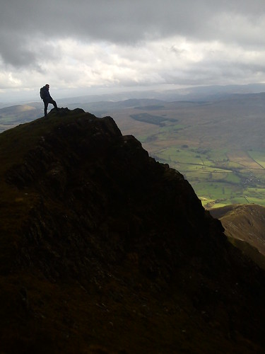
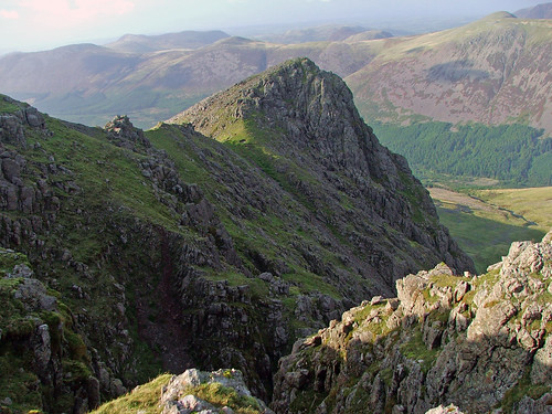
Crag Fast on Sharp Edge - an abortive scramble on Sharp Edgetag:blogs.liverpoolecho.co.uk,2011:/aintnomountainhighenough//980.3821652011-11-12T20:46:50Z2011-11-12T21:36:09ZRichard Downhttp://blogs.liverpoolecho.co.uk/aintnomountainhighenough/Sharp Edge, Blencathra, is not as famous as Striding Edge near Helvellyn or Crib Goch in North Wales but it's still capable of striking fear deep into the racing ventricles of your heart.
From above in good light it is imposing as Flickr mountain photographer Lee Wise's picture shows:
When sliding around on the approach to Bad Step, it's even more intimidating.
]]>
The Crib is undoubtedly longer and more impressive as an Alpine style ridgeline but, in the gathering gloom over the half term holidays, Sharp Edge seemed to leer and threaten in a way the Welsh scramble has never done to me ... yet.
The main problem is that the rocks get very greasy. This is something stressed in numerous blogs and in Trail magazine. However, it is one of the few sections of exposed ridgeline that the Lake District has to offer and as such demands to be climbed. As a result, we saddled up on a morning where sunlight and scudding clouds took turns in filling the sky and decided to ignore all advice and go for it. Today we would nail Sharp Edge. So what if it gets a bit slippery?!
That kind of attidude is easy to maintain on the lower slopes.
Higher up, in a peasouper, with your boots resolutely refusing to grip and several hundred feet of yawning silence opening up behind you, that same bravado feels silly.
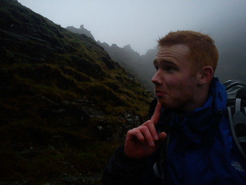
Mark, who had splashed out on some new Scarpa boots just the day before, was comically apprehensive as the gadient steepened.
A few metres higher and the comic element dissolved. With the new boots slithering off friable chunks of rock Mark was "out of his comfort zone". So was I thanks to an ill conceived game of rugby three days previously that had resulted in three cracked ribs.
We backed off.
Instead we wheezed our way up Scales Fell from the tarn and took in the views as the hillfog lifted and fell like a peepshow Mimi.
Once on the main limb of Scale Fell itself we followed the route I'd taken a year ago to the summit. At the top there was little to see except Berghaus and rustling gaiters so we swiftly turned on our expensive boot heels and made for Doddick Fell ridge - a line of descent that would stand out on most mountains but which is overshaddowed by Halls Fell ridge and Sharp Edge itself on Blencathra.
Halfway down sun began punching bright holes in the glowering cloud cover which produced some spectacular scenes.
]]>
Celebrating the All Blacks win - a trip to the foothills of South Island and missed opportunitiestag:blogs.liverpoolecho.co.uk,2011:/aintnomountainhighenough//980.3807802011-10-24T15:06:06Z2011-10-24T15:47:34ZAoraki is a breathtaking sight when it shrugs off its habitual cloak of cloud. I went hunting for my old pictures of the Kiwi icon after the All Blacks satisfying win in the World Cup final. I loved New Zealand...Richard Downhttp://blogs.liverpoolecho.co.uk/aintnomountainhighenough/ Aoraki is a breathtaking sight when it shrugs off its habitual cloak of cloud. I went hunting for my old pictures of the Kiwi icon after the All Blacks satisfying win in the World Cup final. I loved New Zealand but rather like the Welsh team returned from down under rueing a missed opportunity.
South Island is a walker's paradise. It has some of the most spectacular treks, or tramps as they're called by the locals, on the planet.
The Keplar, Routeburn and Milford Tracks are outrageously stunning. I managed a couple of sorties to the Abel Tasman Track at the far north of the island and a shorter walk along the Malborough Sounds Queen Charlotte Track but nothing among the loftier peaks.
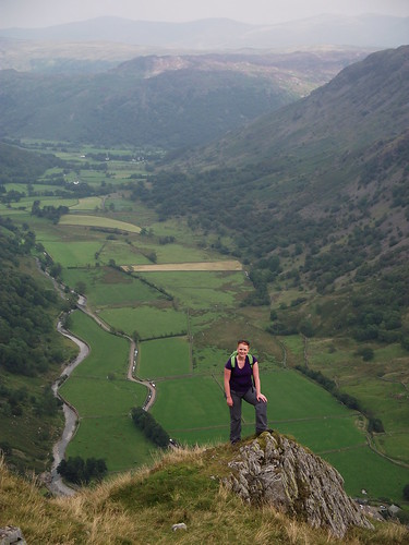
Even more annoying is the fact that I didn't take one of the shorter options out of Queenstown or Wanaka that would have had me out on peaks like these (above) soaring over Lake Wakatipu or opposite these, The Remarkables.
I don't even have the excuse of being sent home by a dodgy refereeing decision. Instead I just didn't get out there enough.
I did get to enjoy the Crater Rim Pathway that ran around Lyttelton Harbour on the Banks Peninsular as I lived about 20 yards from it. It provided cracking views of Governors Bay and Mount Herbert.
Today I live on the edge of another spectacular lump of scenery in the shape of The Lake District. I made an earnest start bagging now 100 Wainwrights and summiting fells on each of the main sections of the region. But recently, I've slacked off. Bad weather, fatigue after doing battle with teenagers for a living and this weekend cracked ribs resulting from a truly ridiculous decision to play rugby aged 34 after an 18 year lay off, have all combined to slow my gallop.
Watching the All Blacks grind out a deserved win has served as a tangential reminder to get on with it. Rather than mooch about, I need to get out there a bit more, starting this week which is afterall half term!.
]]>
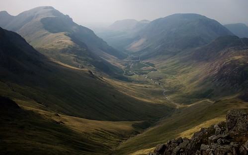
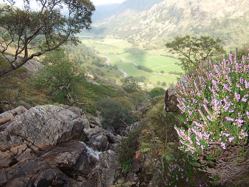
Base Brown and Borrowdaletag:blogs.liverpoolecho.co.uk,2011:/aintnomountainhighenough//980.3789172011-10-08T14:20:31Z2011-10-08T15:15:45ZBase Brown juts into Borrowdale stealing the limelight from its bigger neighbours by virtue of an elegant profile. Once up top it provides a satisfying round with unparalleled views of Ennerdale....Richard Downhttp://blogs.liverpoolecho.co.uk/aintnomountainhighenough/
Base Brown juts into Borrowdale stealing the limelight from its bigger neighbours by virtue of an elegant profile.
Once up top it provides a satisfying round with unparalleled views of Ennerdale.
]]>
However, it's not the views that made it one of the most satisfying outings in the area, it's the chance to get off the well worn tracks that lead inexorably towards Scafell Pike and take on a steep grassy scramble with swooning drops yawning below your feet. Starting on the car lined dead end that leads to Seatoller, the map shows a main path heading through a farmstead and up a hanging valley. Beside the path tumbles Sour Milk Gill, a series of waterfalls that roar above the sound of blood pumping in your ears as you climb.
But once the contours level out the path becomes decidedly pedestrian (no s**t I hear you murmur) and follows the valley floor to the base of Green Gable.
Far better to make like Walt Whitman and leave the well beaten pathway. Lurching directly into the sky are a series of cliffs and boulders that beckon. I convinced Samantha I knew what I was doing and we began to wind our way up and round to the exposed front of Base Brown's nose where the ridge line plunges into Borrowdale. Grass clings onto shelves of rock with tiny, twisting streams of sheep track appearing and petering out between rockfall. On the OS Map there is a fine dotted line denoting a path to a hanging stone. It didn't make itself obvious until we'd crested the steepest section and the valley floor spread into the milky fug of a summer's day.
From this point on the round is a predictable ridgeline walk with wide paths and little to knock you off your stride.
Search and Rescue did their bit to keep us entertained for the best part of 30 minutes as we walked up to the summit of Green Gable.
Either it was making a hash of finding someone on the crags around Brandreth, our next stop, or they were on a training run.
Brandreth and Grey Knotts are the next two peaks on the round and offer superb views into Buttermere and Ennerdale and back towards Base Brown itself.
But the path leads you off towards the Honister Pass and a dreary looking stagger down 5 miles of road if you're looking to return to Seatoller so again we thought it best to leave the path behind and find our way back to the top of Sour Milk Gill. There are some serious looking bogs that needed negotiating before the comfort of a high drystone wall wheels its way to the river bed making and easy pathway to follow.
From there the thudding waterfall races you back to the car and thoughts of ice cream or a pint back in Seathwaite at the head of the Borrowdale valley.
This is a fine round and a good one to squeeze into a long afternoon so long as you don't adhere too strongly to the big green paths marked on the map.
Other blogs on this area:
Lovely photos of the slopes of Base Brown and Sour Milk Gill by Loweswatercam. in gorgeous light.
Richard Ratcliffe's summiteer blog has a couple of nice shots of the last remnants of snow in the many gullies.
Though I presume Walkhighlands took the pedestrian route up as Base Brown only gets a two star rating.
]]>
Mountains of the mind - 110 of the best landscape shots I've seentag:blogs.liverpoolecho.co.uk,2011:/aintnomountainhighenough//980.3762772011-09-25T10:17:26Z2011-09-25T10:39:29ZTeacher training is eating up large parts of my weekends and preventing me from getting out on the Lake District fells as much as I'd like.Then I go on Flickr and see contacts take wonderful pictures of their experiences and...Richard Downhttp://blogs.liverpoolecho.co.uk/aintnomountainhighenough/
Teacher training is eating up large parts of my weekends and preventing me from getting out on the Lake District fells as much as I'd like. Then I go on Flickr and see contacts take wonderful pictures of their experiences and the wanderlust grows.
by bobboil5 I compound my misery by clicking on My Favourites, a list of shots I've fallen in love with since opening my Flickr account in 2008. They are stunning and the mountains of paperwork I have to get through seem even less attractive when directly compared to the real ones 10 miles down the road.
]]>
I'd hoped to bung up a slideshow of them but here's a link and here is a taste of what you'll find.
]]>
Specific fitness - a feeble attempt at a mini biathlon in Buttermeretag:blogs.liverpoolecho.co.uk,2011:/aintnomountainhighenough//980.3736472011-08-31T13:21:04Z2011-09-10T16:00:52ZI have a nice old steel framed road bike locked up in my shed. Just next to it is a nice old steel framed mountain bike. They have a collective age of about 45. They don't see much action in...Richard Downhttp://blogs.liverpoolecho.co.uk/aintnomountainhighenough/
I have a nice old steel framed road bike locked up in my shed. Just next to it is a nice old steel framed mountain bike. They have a collective age of about 45. They don't see much action in the normal course of things. But, just recently, I've been toying with the idea of cycling to some hills before climbing them and cycling back. The long spine of Knott Rigg and Ard Crags is about 12 miles has called out to "be done" and is just one decent road pass away.
Not too difficult the map seemed to suggest. That is until you clap your backside onto the steel framed so-called saddle and try peddle from more than 20 minutes...
It's about then that the enthusiasm and adrenaline dry up pretty much simultaneously.
And the selected hills are still 10 miles away.
The Newlands Pass (right) has not yet been attempted.
And the bum has become worryingly numb.
Still, if you have to have an entirely sensation free backside and a pair of burning thighs, Buttermere would be among the best places to undergo the experience.
Placid waters, well placed trees and the odd red squrrel (some even alive rather than unfortunately pasted on the roadway by carless motorists) make the ride almost pleasurable.
Almost.
Saddle notwithstanding - or sitting.
The road wriggles along the steepsided valley and moments before my legs promised to drop off entirely, I reached the top of the Newlands Pass between Keswick and Buttermere.
From there it's only a short walk to the summit of Knott Rigg and an amble across heathery tops to Ard Crags. Below the Newlands Pass trickles innocently towards Derwent Water.
Across the valley Cat Bells and Maiden Moor crowd round green fields. Beyond them, merging with the horizon, the misty peaks of Helvellyn unfurl.
With another two Wainwrights bagged and my derriere beginning to buzz back into uncomfortable life, it was time to enjoy the thrill of freewheeling back down the pass and homewards.
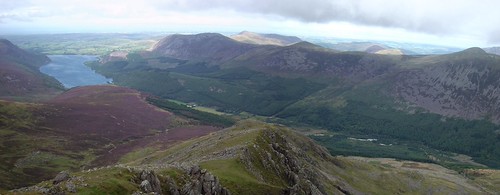
Leaving Knott Rigg, Robinson and Red Pike (above) competing for what little sunlight Cumbria offers even in the summer.
Steeple from Ennerdale - another five Wainwrights baggedtag:blogs.liverpoolecho.co.uk,2011:/aintnomountainhighenough//980.3734982011-08-30T09:19:40Z2011-08-30T11:10:05ZSteeple soars above lonely Ennerdale, the pinnacle at the top of an inviting ridge. On a half decent day it looks like professional landscape tog Andy Beck's photograph (above). It's a pretty decent route up a fairly big hill but...Richard Downhttp://blogs.liverpoolecho.co.uk/aintnomountainhighenough/ Steeple soars above lonely Ennerdale, the pinnacle at the top of an inviting ridge. On a half decent day it looks like professional landscape tog Andy Beck's photograph (above). It's a pretty decent route up a fairly big hill but is not often walked as it's about as remote as anything the Lake District has to offer.]]>
Just to get to the bottom of the hill you have to drive to Ennerdale water, which is a good way from anywhere, then park at the head of the lake and walk at least two miles along Land Rover tracks to the base of the climb.
You have to keep your eyes peeled for the path up through the woodland. Once on it the path climbs pleasantly up through heather and tree roots alongside a deepening chasm containing roaring waterfalls and sheer cliffs. Halfway up it's easy to get literally sidetracked on a forest road back towards Pillar. Beyond the trees the path becomes a sheeptrack and some steady plodding rewards you with excellent views right along Ennerdale and out into northern Cumbria.
This was an August Bank Holiday so obviously it was blowing a gale and freezing cold. The clag swept in from the west periodically limiting the number of shots I could take. The rocks get ever more impressive and for a few minutes I had to shelter behind them on the steep side of Steeple as gusts blew in strong enough to make me stumble. Steeple's summit is an Alpine cone of land linked to Scoat Fell by a narrow ridge of grass and rock.
Alan-W's shot captures the steep promontary perfectly.
Scoat Fell has tremendous views over towards Pillar and then down into the hanging valleys above Wasdale. Gaps between the crags provide scenic frames for Lakeland giants like Great Gable.
On Sunday the light changed with each passing moment as clouds gave way to brief glimpses of sunlight.
The wind was fierce and cut through my oh so summery garb of T-shirt, Softshell, Heavy fleece and Berghaus raincoat. Standing round taking too many photos was not on the cards. My aim was to pick off Steeple, Scoat Fell and Red Pike (Wasdale). Together these make up almost half of the Mosedale Round that Ian and I aborted in the Spring. Wainwright seems quite keen on the mile long escarpment that is Red Pike. On one side it falls pleasantly into Wasdale. On the other it presents a gnarled grin full of rock and scree.
To pick off Haycock and Caw Fell on my erratic round I avoided climbing back up the path I'd just followed and made my way along the grassy slopes of Little Scoat Fell to the coll. By this point the clouds had descended and any further views were cut off. More fortunate walkers have revelled in these sorts of vistas.
]]>
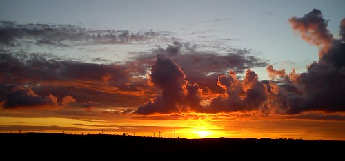
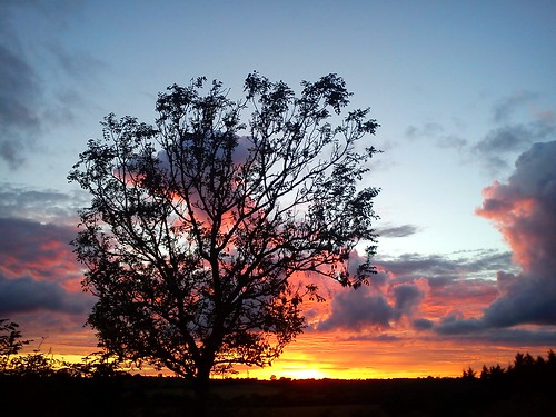
Sunset on the edge of the Lake Districttag:blogs.liverpoolecho.co.uk,2011:/aintnomountainhighenough//980.3728352011-08-20T11:15:23Z2011-08-20T11:30:11ZLiving on the edge of the hills my focus is often south towards the likes of Grasmoor and the Buttermere valley or the hulking girt frame of Skiddaw. But facing westward means that every so often the skies refuse to...Richard Downhttp://blogs.liverpoolecho.co.uk/aintnomountainhighenough/
Living on the edge of the hills my focus is often south towards the likes of Grasmoor and the Buttermere valley or the hulking girt frame of Skiddaw. But facing westward means that every so often the skies refuse to be ignored.
]]>
Even soggy fields on outskirts of the village look pretty amazing.
While in widescreen Workington, hardly the capital of the landscape photographer's world, is transformed, wind turbines and all, into a strangely beautiful apocolyptic vision.
Even sickly trees were made to look starkly impressive.
It wouldn't all fit into a single shot, and I'd not taken Samantha's clever Fuji camera that stiches shots into a panorama, so I took this mini video.
It all goes to show that sometimes the edge of the National Parks, where the land flattens out, can sometimes yield good photo ops too. ]]>
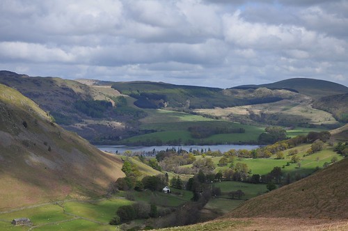
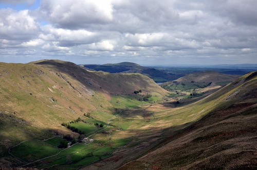
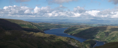
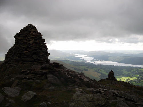
The Kentmere Round - Nine Wainwrights in the Far Eastern Fellstag:blogs.liverpoolecho.co.uk,2011:/aintnomountainhighenough//980.3725172011-08-16T16:19:01Z2011-08-16T17:17:47Z The Kentmere Round takes in nine Wainwrights in about 13 miles. It also provided me with my first glimpse of Haweswater....Richard Downhttp://blogs.liverpoolecho.co.uk/aintnomountainhighenough/
The Kentmere Round takes in nine Wainwrights in about 13 miles. It also provided me with my first glimpse of Haweswater.
]]>
Monday was said to be the best day of the week. On this they all agreed. The heavy clouds should then have come as little surprise. With more than 1,000m of climbing over the course of about 7 hours, we were a mite disappointed that the first two miles were spent fog bound. We'd started late and bagged a dubious parking spot at the church in Kentmere itself. Tucked at the end of a valley running parallel to Windermere on single track roads there is not much space for the Wainwright baggers than descend on the tiny village each day. Having found a space though the clouds rolled in and our summer kit was set to be tested by 12 degree temperatures and wind-blown drizzle. It was an inauspicious start. The route (taken from Peter Burgess's walking blog):
But the route is quite tame and you take out your first Wainwright, Yoke (706m), without breaking sweat and on massive stoney paths.
The next hill has a mighty profile from the valley floor. It's a steep sided conical whopper that is crowned with three hefty towers of rocks that defy any normal description of 'cairn'. It was at the foot of the middle cairn that we stopped and glumly ate soggy sandwiches with a canvas bag protector on my head to ward off the rain - my soft shell had no hood; why would I need one given the universal promise of sunshine? But as the last damp, wholemeal slab forced its way down the clouds broke.
Windermere unfurled under annoyingly bright skies and patches of sharp green fortold better weather was approaching.
As we stood and looked down the valley Froswick (720m) emerged from the gloom.
A static wave of green with spray lifting from its crest. Beyond it Thorntwaite Crag and still sumberged in the gloop, High Street.
The Kentmere valley is deep and impressive. In the murk it didn't shape up for any decent shots but suddent glimpses towards the resevoir below and of the massive grassy drops would appear and skip from view again in tantalising bursts. Flickr user Roantrum has some great shots of the valley without the clag, as does Phil Walker aka BigPhilUK.
But by the time we got to High Street the clouds had fully lifted providing glorious views towards Helvellyn and over the Ullswater fells.
The clag threatened to land a few more times and angry looking anvil shaped clouds plumed to the north:
But just when you thought you were really in for it, they cleared to provide a whole new vista of a part of the Lake District I have never seen before.
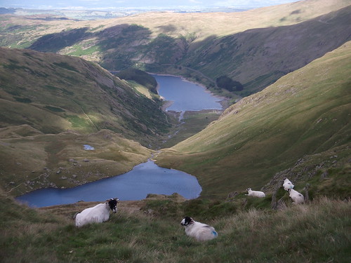
Haweswater is the wrong end of the National Park for me. It demands a drive nearing two hours to get to it. So when it began to peak out from behind the long tapering fells beneath High Street, I was entranced. Even the sheep had arranged a lazy dinner overlooking the resevoir.
By this point both my long suffering / Wainwright bagging convert wife and I were getting hungry. As is always the way, the few miles back down a couple of little hills to the car took longer than the 10 expected minutes. In fact from Harter Fell where the sheep were enjoying their lazy teatime, it was another hour and a half to the car. Unlike many descents though, this one didn't kill the knees.
Samantha claimed at the bottom that she preferred challenging steep hills to the long, multi peak rounds and has therefore opened the floodgates. No more nice undulating mountain trails. The next outing shall be a beast.
Personally, nine peaks and views from Grange over Sands to Yorkshire and right over to the Irish Sea at Wasdale takes some beating even on after a soaking.
]]>
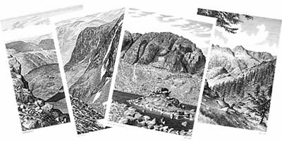
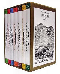
Hill heretic - Wainwright's starting to really pee me offtag:blogs.liverpoolecho.co.uk,2011:/aintnomountainhighenough//980.3722482011-08-12T14:17:14Z2011-08-12T15:57:14ZAlfred Wainwright's Lake District guidebooks are beautiful things. His attention to detail and meticulous drawings have done as much to popularise the Lake District as Beatrix Potter and William Wordsworth. Since moving to the edge of the Lake District exactly...Richard Downhttp://blogs.liverpoolecho.co.uk/aintnomountainhighenough/
Alfred Wainwright's Lake District guidebooks are beautiful things. His attention to detail and meticulous drawings have done as much to popularise the Lake District as Beatrix Potter and William Wordsworth. Since moving to the edge of the Lake District exactly a year ago I've become a Wainwright bagger and have climbed a third of all the fells he describes in exquisite detail through drawings, maps and words
But the more time I spend on the Cumbrian fells, the more irritating I'm starting to find my ghostly guide. The attention to detail that helped fashion his fabulous seven volume series is now starting to get up my nose. In particular one passage when describing one of the Lake's finest peaks has been eating away at me for a couple of months now...
In Book Seven - The Western Fells Wainwright suddenly deviates from describing Great Gable to launch this treatise on good walkers and bad walkers:
"There are good walkers and there are bad walkers, and the difference between them has nothing to do with performance in mileage or speed. The difference lies in the way they put their feet down.
"A good walker is a tidy walker. He moves quietly, places his feet where his eyes tell him to, on beaten track treads firmly, avoids loose stones on steep ground, disturbs nothing. He is, by habit, an improver of paths.
"A bad walker is a clumsy walker. He moves noisily, disturbs the surface and even the foundations of paths by kicked up loose stone, tramples the verges until they disintergrate into debris. He is, by habit, a maker of bad tracks and a spoiler of good ones.
"A good walker's special joy is zigzags, which he follows faithfully. A bad walker's special joy is in shortcutting and dstroying zigzags.
"All fellwalking accidents are the result of clumsiness."
This fussy little manefesto has begun to drive me mad out on the hills. Almost every step I take on the hills is now either a conscious effort to rebel or conform with Wainwright's edict.
There is undoubtedly merit in what he's saying. Chewed up fells, where braided lines of paths have now intertwined to such an extent that hillsides look like riverbeds devoid of grass or shape thanks to wandering feet, are a disappointing eyesore.
But they are more the result of sheer numbers out on the hills than of 'bad walkers' as Wainwright would have us believe.
One of the real joys of fellwalking and scrambling is getting off the beaten track and finding your own way up a mountain, through a narrow gorge or across a gnarly looking section of cliff. All too often the paths marked out on the map or in Wainwright's books are a dull plod on rubble strewn paths up the safest lines the fell has to offer. Sticking to these highways on the hills is often a dull chore. They aid those who are aiming to 'do' a hill or a round but who might not enjoy feeling their way along a likely looking ridge or up a challenging sweep of hillside for its own right.
In short, it's the pontification of a conservative.
While mountaineer Doug Scott, another Lakeland devotee and resident, talks about doing something new, Wainwright seems to want you to carefully tread the lines laid out by Trusts and Councils.
Hillwalking, and in its more exciting guise, moutaineering, should be more about discovery and escaping. Faithfully sticking to the path means following someone else's plan for your day out, it means keeping in step with an agreed pattern for recreation. That's not why I get out on the hills.

 I set off at a furious pace and then remembered how unfit I am thanks to a coronary halfway up the approach from Swirls Car Park near Thirlmere - a popular place to climb Helvellyn. From the bottom the bluff is quite imposing and you need to find the base of the obvious big buttress to begin the climb. From there it's pretty straightforward with little to get your knickers in a twist. The only technical bit is Riley's Window at the top of the climb but that is easily bypassed.